|
Search, browse, and study this dictionary to learn more about the early American, Christian language. 
1828.mshaffer.com › Word [chart]
CHART, n. A hydrographical or marine map; a draught or projection of some part of the earths superficies on paper, with the coasts, isles, rocks, banks, channels or entrances into harbors, rivers, and bays, the points of compass, soundings or depth of water, &c., to regulate the courses of ships in their voyages. The term chart is applied to a marine map; map is applied to a draught of some portion of land. A plan chart is a representation of some part of the superficies of the globe, in which the meridians are supposed parallel to each other, the parallels of latitude at equal distances, and of course the degrees of latitude and longitude are every where equal to each other.Mercators chart, is one on which the meridians are straight lines, parallel and equidistant; the parallels are straight lines and parallel to each other, but the distance between them increases from the equinoctial towards either pole, in the ratio of the secant of the latitude to the radius.Globular chart, is a meridional projection in which the distance of the eye from the plane of the meridian, on which the projection is made, is supposed to be equal to the sine of the angle of forty-five degrees.Selenographic charts, represent the spots and appearances of the moon.Topographic charts, are draughts of particular places, or small parts of the earth.
|
Evolution (or devolution) of this word [chart]
| 1828 Webster | 1844 Webster | 1913 Webster |
|---|
CHART, n. A hydrographical or marine map; a draught or projection of some part of the earths superficies on paper, with the coasts, isles, rocks, banks, channels or entrances into harbors, rivers, and bays, the points of compass, soundings or depth of water, &c., to regulate the courses of ships in their voyages. The term chart is applied to a marine map; map is applied to a draught of some portion of land. A plan chart is a representation of some part of the superficies of the globe, in which the meridians are supposed parallel to each other, the parallels of latitude at equal distances, and of course the degrees of latitude and longitude are every where equal to each other.Mercators chart, is one on which the meridians are straight lines, parallel and equidistant; the parallels are straight lines and parallel to each other, but the distance between them increases from the equinoctial towards either pole, in the ratio of the secant of the latitude to the radius.Globular chart, is a meridional projection in which the distance of the eye from the plane of the meridian, on which the projection is made, is supposed to be equal to the sine of the angle of forty-five degrees.Selenographic charts, represent the spots and appearances of the moon.Topographic charts, are draughts of particular places, or small parts of the earth. |
CHART, n. [L. charta, the same as card, which see.]A hydrographical or marine map; a draught or projection on paper, of some part of the earth's superficies, with the coasts, isles, rocks, banks, channels, or entrances into harbors, rivers, and bays, the points of compass, soundings or depth of water, &c. to regulate the courses of ships in their voyages. The term chart is applied to a marine map; map is applied to a draught of some portion of land.
A plane chart, is a representation of some part of the superficies of the globe, in which the meridians are supposed parallel to each other, the parallels of latitude at equal distances, and of course the degrees of latitude and longitude are every where equal to each other.
Mercator's chart, is one on which the meridians are straight lines, parallel and equidistant; the parallels are straight lines and parallel to each other, but the distance between them increases from the equinoctial toward either pole, in the ratio of the secant of the latitude to the radius.
Globular chart, is a meridional projection in which the distance of the eye from the plane of the meridian; on which the projection is made, is supposed to be equal to the sine of the angle of forty-five degrees.
Selenographic charts, represent the spots and appearances of the moon.
Topographic charts, are draughts of particular places, or small parts of the earth. – Encyc. |
Chart
- A
sheet of paper, pasteboard, or the like, on which information is
exhibited, esp. when the information is arranged in tabular form;
as, an historical chart.
- To lay down in a chart] to
map; to delineate; as, to chart a coast.
- A map; esp., a hydrographic or marine
map; a map on which is projected a portion of water and the land
which it surrounds, or by which it is surrounded, intended
especially for the use of seamen; as, the United States Coast
Survey charts; the English Admiralty
charts.
- A written deed; a charter.
|
| 1828 Webster | 1844 Webster | 1913 Webster |
|---|
Thank you for visiting!
- Our goal is to try and improve the quality of the digital form of this dictionary being historically true and accurate to the first American dictionary. Read more ...
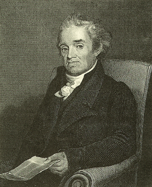
- Below you will find three sketches from a talented artist and friend depicting Noah Webster at work. Please tell us what you think.
Divine Study
 
Divine Study
|
Window of Reflection
 
Window of Reflection
|
Enlightening Grace
 
Enlightening Grace
|
160
|
939 |
116
|
1020 |
190
|
1057 |

Chart CHART, noun A hydrographical or marine map; a draught or projection of some part of the earths superficies on paper, with the coasts, isles, rocks, banks, channels or entrances into harbors, rivers, and bays, the points of compass, soundings or depth of water, etc., to regulate the courses of ships in their voyages. The term chart is applied to a marine map; map is applied to a draught of some portion of land. A plan chart is a representation of some part of the superficies of the globe, in which the meridians are supposed parallel to each other, the parallels of latitude at equal distances, and of course the degrees of latitude and longitude are every where equal to each other. Mercators chart is one on which the meridians are straight lines, parallel and equidistant; the parallels are straight lines and parallel to each other, but the distance between them increases from the equinoctial towards either pole, in the ratio of the secant of the latitude to the radius. Globular chart is a meridional projection in which the distance of the eye from the plane of the meridian, on which the projection is made, is supposed to be equal to the sine of the angle of forty-five degrees. Selenographic charts, represent the spots and appearances of the moon. Topographic charts, are draughts of particular places, or small parts of the earth. |

|
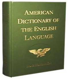
| Hard-cover Edition |
372 |
 |
549 |
|
| Compact Edition |
356 |
 |
249 |
|
| CD-ROM |
305 |
 |
195 |
|
* As a note, I have purchased each of these products. In fact, as we have been developing the Project:: 1828 Reprint, I have purchased several of the bulky hard-cover dictionaries. My opinion is that the 2000-page hard-cover edition is the only good viable solution at this time. The compact edition was a bit disappointing and the CD-ROM as well. |
| [ + ] |
| Add Search To Your Site |
|
|
|